It is mentioned in written sources as a village in 1663, in the Pinsk district of the Grand Duchy of Lithuania. It belonged to Jan Karol Dolski.
At the end of the 18th century, the village was part of the Chomsk county. According to the 1793 inventory, there were 11 households and 64 inhabitants.
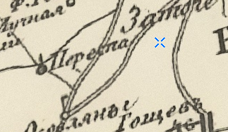
From 1795, it was part of the Russian Empire. The village is marked on Schubert's map (1826–1840):
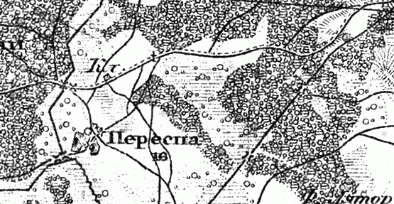
It is also marked on the military topographic map (1846–1863):
In 1860, there were 127 registered souls in the village. In 1905, there were 274 inhabitants. During World War I, the village was burned down.
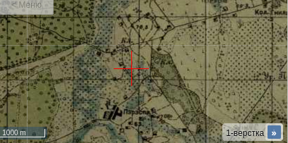
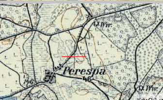
The village on the one-verst map:
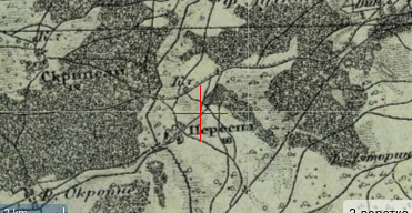
And on the three-verst map:
From 1921 to 1939, it was part of Poland. In 1921, the village had 39 households and 221 inhabitants.
The ethnic composition was predominantly Polish, with Belarusian minority. Religiously, most inhabitants were Orthodox.
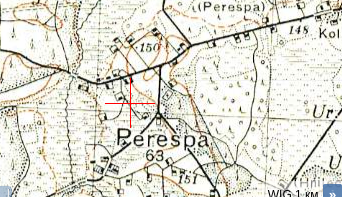
The village on the Polish WIG map:
From 1939, part of the Belarus SSR. In 1940, the village had 58 households and 329 inhabitants.
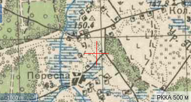
The village on the Red Army map:
Also on the German KDWR map:
During World War II, 14 residents were killed, including 9 at the front.
Population: 353 (1960), 346 (1970), 131 (1995).