Pigas is mentioned in 1777, in the Radogoszcz volost, Brest Voivodeship, Grand Duchy of Lithuania.
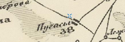
From 1795, it became part of the Russian Empire. The village is shown on Schubert’s map (1826–1840):
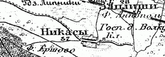
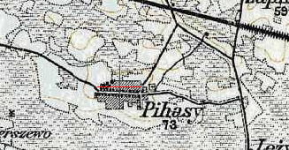
Also on the military topographic map of the Russian Empire (1846–1863):
In 1858, the village had 231 revision souls (state peasants). In 1905, there were 438 inhabitants.
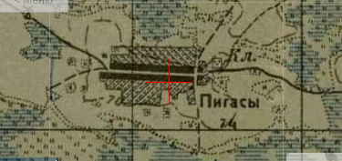
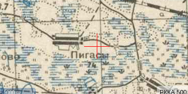
The village on the one-verst map:
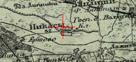
Also on the three-verst map:
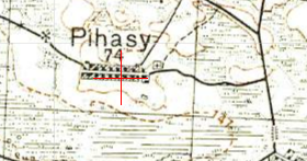
From 1921 to 1939, it was part of Poland. In 1921, there were 32 households and 130 inhabitants.
From 1939, part of the Belarus SSR. In 1939, there were 93 households and 686 inhabitants.
During the Great Patriotic War, 10 residents of the village died at the front.
Since 1954, it has been part of the Brest region. In 1970 there were 342 residents, in 1995 there were 93 households and 161 residents.